
La Guajira, Colombia: The Desert Peninsula That Will Catch You Off Guard
La Guajira is unlike anywhere else in Colombia: a windswept desert peninsula where sand dunes drop into the Caribbean, flamingos wade in coastal lagoons, and the Wayuu people have called this land home for centuries.
IDIOMA DEL ARTÍCULO
Showing original language
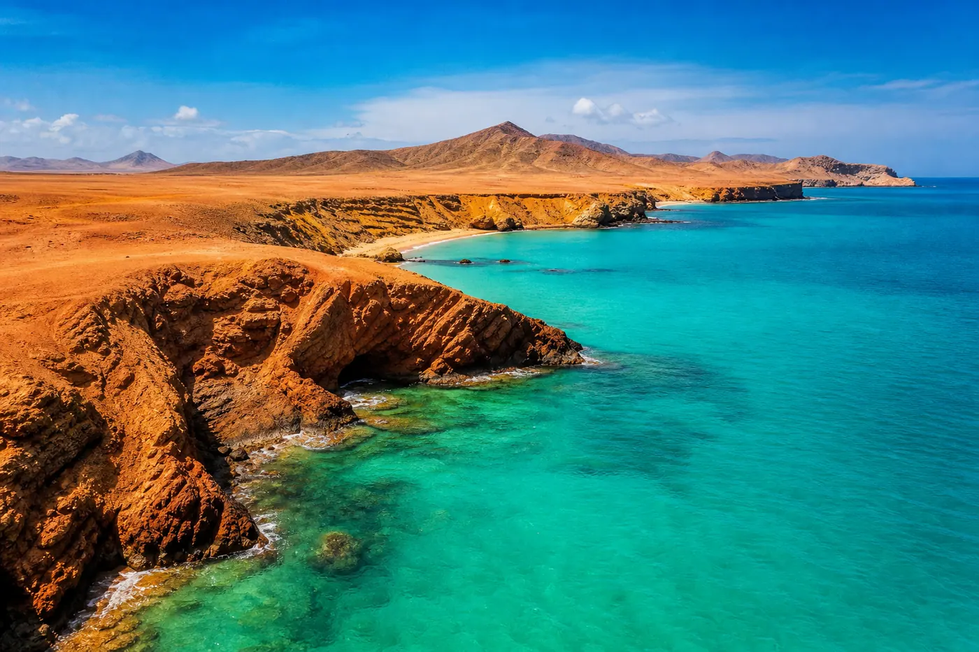
Most people's mental image of Colombia is green mountains, cumbia-soaked evenings, and the comfortable chaos of city life. La Guajira obliterates that image. This is arid, windswept desert in the far north — where ochre cliffs drop straight into turquoise Caribbean water, flamingos wade through shallow lagoons, and the Wayuu people have been navigating trade winds and outside pressure for centuries without yielding to either.
I went not knowing what to expect. I came back talking about it to everyone who'd listen. La Guajira is simultaneously one of Colombia's most logistically challenging destinations and one of its most rewarding. The crowds that saturate El Peñol or Tayrona mostly haven't made it this far north — which means if you do make the trip, you're getting landscapes largely to yourself.
The peninsula stretches from Riohacha, Colombia's windiest city, up to Punta Gallinas — the northernmost point in all of South America. That's roughly 200 kilometers of increasingly arid, remote, and extraordinary terrain. You don't drive it yourself. You book a tour, go with a Wayuu guide family, and step into a world that doesn't match any other corner of the country.
🌵 La Guajira at a Glance
- Base city: Fly or bus to Riohacha — 1.5h from Barranquilla by air, 3–4h by bus from Santa Marta
- Tours: Book 2–4 day guided tours; expect 200,000–600,000 COP/person/day (~$50–$150 USD)
- Best time: December–April (dry season, clear roads, strong wind, brilliant stars)
- Main draws: Cabo de la Vela, Punta Gallinas dunes, flamingo lagoons at Camarones, Wayuu rancherías
- Critical logistics: No ATMs beyond Riohacha — bring all cash. No reliable electricity in remote areas. Self-driving is not recommended.
What Makes La Guajira Different
La Guajira is a department — Colombia's northernmost state — sharing its eastern border with Venezuela. It's divided informally into Baja Guajira (lower, more populated, near Riohacha), Media Guajira (transitional scrubland), and Alta Guajira (the upper peninsula — Cabo de la Vela, Bahía Portete, Punta Gallinas). The higher you go, the more remote and the more extraordinary.
About 90% of the department is Wayuu territory. The Wayuu are Colombia's largest indigenous group, with roughly 400,000 people split between Colombia and Venezuela. They're matrilineal, fiercely autonomous, and have maintained their own legal and governance systems for centuries — including the word pütchipü'üi, a professional dispute mediator recognized under Colombian law. When you're in Alta Guajira, you're a guest in their home. That's not a metaphor.
What draws visitors is a combination you won't find anywhere else in Colombia: cactus forests, sand dunes plunging into the Caribbean, hundreds of flamingos in shallow lagoons, and nights so dark that the Milky Way is genuinely visible. The only annoying part is getting there — the logistics are real. But once you're in, you understand immediately why people come back.
The Main Destinations
Riohacha — The Gateway
Riohacha is La Guajira's capital and your starting point for any trip into the peninsula. Most travelers fly in from Bogotá or Medellín (Avianca and LATAM serve the route; budget 150,000–400,000 COP each way), or take the bus from Santa Marta — roughly 3–4 hours and 30,000–45,000 COP. If you're coming from further south, the bus network is solid and considerably cheaper than flying.
The city itself has a decent malecon (waterfront promenade), some good seafood restaurants, and a busy artisanal market where you'll get your first look at Wayuu mochilas — the hand-woven shoulder bags that are everywhere once you enter the peninsula. Spend one night in Riohacha, book your tour, stock up on cash and snacks, and leave early the next morning. Afternoons in the Guajira are hot and the roads deteriorate in the heat.
Cabo de la Vela
Cabo de la Vela is where most 2–3 day tours end up, and it delivers. The settlement is tiny — maybe 500 people living on a narrow sand spit — but the visual effect is dramatic: rust-colored desert on one side, impossible Caribbean blue on the other, and horizon in all directions. It's the kind of place you photograph constantly without ever quite capturing it.
The main hike here is Pilón de Azúcar — a small rocky hill with a statue of the Virgin at the top and a 360-degree panorama of the peninsula below. It's steep in sand, takes about 45 minutes round trip, and is worth every step. After that, the beach at Cabo is one of the best kitesurf spots in South America — the wind is relentless — and the sunsets are the kind that make you question your life choices about where you live. Accommodation is in simple Wayuu rancherías: hammocks strung in thatched huts, basic shared bathrooms, and meals of whatever was caught that day. Nights are extraordinary — zero light pollution, every star visible.
Punta Gallinas — The Northernmost Point
Punta Gallinas requires more commitment: usually an extra day on top of a Cabo itinerary, accessible only by 4x4 across unmarked desert tracks and a small boat crossing over Bahía Portete. The road to Punta Gallinas has swallowed more than a few vehicles — it's not a DIY route. But the effort is earned.
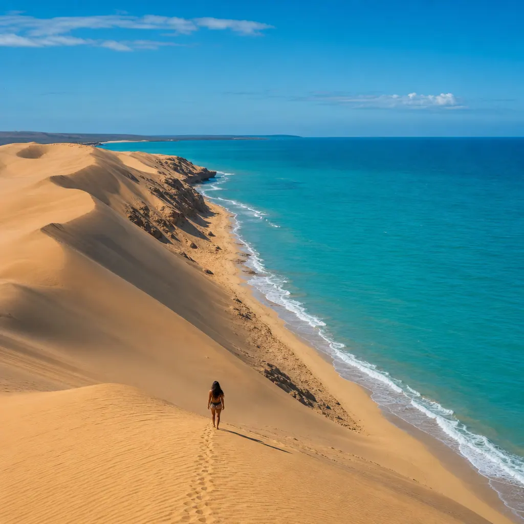
At Punta Gallinas, you're standing at the northernmost tip of South America. There's a small lighthouse, hammock accommodation operated by a single Wayuu family, and the Taroa Dunes — massive sand formations that roll directly into the sea. Swimming at the base of a dune while the Caribbean wraps around you is a genuinely strange and excellent experience. If you can stay overnight, do it. Sunrise over the dunes before the day-trip convoy arrives from Riohacha is worth the extra night.
Flamingos at Camarones
On the road between Riohacha and Cabo de la Vela, Camarones sits beside Laguna de los Flamencos — a shallow coastal lagoon where several hundred flamingos feed year-round. Most group tours stop here for 30–45 minutes; you hire a local wooden boat for 20,000–30,000 COP per person and drift quietly through the lagoon. It's a low-key stop but consistently one of the most memorable moments of the trip. Flamingos in the wild, against a backdrop of desert scrubland, are just improbable enough to surprise you every time.
How to Get There and Book a Tour
Self-driving in Alta Guajira is not recommended for anyone unfamiliar with the terrain. Roads become unmarked tracks, tracks disappear into salt flats, and navigation relies on local knowledge that GPS doesn't capture. The Colombian military has gotten stuck here. Go with a guide.
Your two main options: book a group tour through operators in Taganga, Santa Marta, or Riohacha (cheapest, most common, usually shared 4x4 trucks with accommodation and meals included), or book directly with a Wayuu family in Riohacha or Uribia for a more personal experience where more money stays in the community. The second option costs more upfront but is often the better trip.
| Tour Type | Cost/Person/Day (COP) | Approx USD |
|---|---|---|
| Budget group tour (shared 4x4) | 200,000–280,000 | ~$50–$70 |
| Mid-range guided tour | 300,000–400,000 | ~$75–$100 |
| Private Wayuu family-hosted | 450,000–600,000 | ~$115–$150 |
| Flights Bogotá → Riohacha (each way) | 150,000–400,000 | ~$38–$100 |
A standard 3-day / 2-night trip (Riohacha → Camarones → Cabo de la Vela → Punta Gallinas) runs roughly 600,000–900,000 COP per person all-in on a group tour, excluding flights to Riohacha. Shop for operators in Taganga — it's competitive and you can negotiate slightly in low season.
For any trip this remote, travel insurance isn't optional. I use SafetyWing — it covers medical evacuation and emergency treatment, which matters when the nearest hospital is hours away. You can see what's included in our full Colombia travel insurance guide.
📚 Keep Reading
Bus Travel in Colombia: Routes, Safety, and What to Expect — getting from Bogotá or Medellín to the Caribbean coast is easiest by bus. Here's how.
Wayuu Culture — What to Know Before You Go
The Wayuu aren't a tourist backdrop. They're a living, sovereign people running their own legal systems, managing their own clan disputes, and hosting travelers out of genuine economic need in a region with very little else. The respectful version of tourism here doesn't need a long lecture — just a few concrete things:
- Bring practical gifts for your host family — coffee, sugar, rice, or cooking oil. Ask your tour operator what's most useful. Cash given directly to children creates dependency; gifts to families create dignity.
- Always ask before taking photos — some Wayuu are comfortable with it, many aren't. A declined request is a complete sentence; don't negotiate it.
- Buy mochilas at fair prices — a quality Wayuu mochila takes 2–4 weeks to weave by hand. If someone is asking 150,000–300,000 COP for a mochila, that's fair, not a rip-off. This is how families in the Guajira eat.
- Conserve water — La Guajira has a documented water crisis. Children in some communities walk for hours to reach fresh water. Don't waste it for a shower or rinsing your water bottle.
- Learn a word of Wayuunaiki — "Maita" (thank you) is enough to start. The effort matters more than the pronunciation.
Your tour operator should brief you on all of this before you arrive at any ranchería. If they don't, ask. A guide who's dismissive about Wayuu protocols is a guide who hasn't earned the access they're selling you.
Best Time to Visit and What to Pack
December through April is the dry season and the best time to visit La Guajira by a significant margin. Roads are firm, the sky is cloudless, and the wind — which is constant — is strong and cooling rather than unpredictably wild. Cabo de la Vela fills with kitesurf tourists in January and February, but it's still not crowded by Colombian tourist standards.
Avoid September through November if you can. The lluvias (rains) arrive and road conditions in Alta Guajira can become genuinely impassable — some tours cancel outright. May through August is workable: hotter, some road unpredictability, but lower prices and fewer people. If budget is the priority and schedule is flexible, the shoulder season makes sense.
🎒 La Guajira Packing Checklist
- Sunscreen SPF 50+ (the UV is brutal at sea level here)
- A hat that ties or straps under your chin — the wind will steal anything else
- Lightweight sleeping bag or blanket (desert nights get cold)
- All the cash you'll need — no ATMs beyond Riohacha
- Reusable water bottle and electrolyte tablets
- Snacks (food is simple in remote areas — supplement with your own)
- Sandals for the beach and sturdy shoes for rocky trails
- Portable battery pack (no electricity means no charging)
- Offline maps downloaded (Google Maps works offline; signal is spotty)
One more practical note: phone signal disappears past Uribia and is non-existent in most of Alta Guajira. Download offline maps before you go. The Colombia climate guide has more on reading Colombia's regional weather patterns if you're planning a longer trip around multiple regions.
📚 Keep Reading
Colombia's Best Beach Towns for Expats — if La Guajira sparked your interest in the Caribbean coast, this guide covers Palomino, Taganga, Capurganá, and the islands.
Frequently Asked Questions
❓ Is La Guajira safe to visit?
Yes, for organized tours it's considered safe. The main risks are logistical rather than criminal — roads, extreme heat, dehydration. Go with a reputable operator, tell someone your itinerary, and don't attempt solo 4x4 travel in Alta Guajira. The border areas near Venezuela are a different matter and not on any tourist route.
❓ Can I drive to Cabo de la Vela on my own?
Technically yes, but it's strongly discouraged unless you have significant desert off-road experience and know the terrain. There are no road signs, tracks fork constantly, and a breakdown in the remote Guajira is a serious situation. The vast majority of visitors — including experienced travelers — go with a guide. It's the right call.
❓ How many days do I need in La Guajira?
Three days minimum to hit the main spots: Camarones flamingos, Cabo de la Vela overnight, Punta Gallinas day trip and return. Four days is better — it gives you a full day at Cabo to explore properly rather than rushing. Two days gets you to Cabo but misses Punta Gallinas, which is the highlight for many people.
❓ Are flamingos in La Guajira year-round?
Yes. The Laguna de los Flamencos at Camarones hosts flamingos throughout the year, though numbers are typically higher during the dry season (December–April) when the lagoon water level drops and feeding conditions are better. You're almost certain to see them regardless of when you visit.
❓ Do I need to speak Spanish for a La Guajira tour?
Basic Spanish helps with booking and logistics in Riohacha. Many tour operators catering to foreign visitors have some English. In Alta Guajira itself, the primary language is Wayuunaiki — your Wayuu guide will translate. You don't need Spanish for the experience, but some comes in handy for shopping and navigating Riohacha before the tour.


Comments
Loading comments...
Checking sign-in status...