Hiking in Colombia: The Best Treks for Every Level
From Ciudad Perdida's 1,200 stone steps to Cocora Valley's 60-meter wax palms — the honest guide to Colombia's best hikes, with real costs and what to skip.
IDIOMA DEL ARTÍCULO
Showing original language
Most people don't think of Colombia as a hiking destination. They think Cartagena's walls, Medellín's cable cars, the Coffee Region's coffee tours. The hiking scene sits in the background, quietly holding some of the most varied terrain on the continent.
I changed my mind after doing the Ciudad Perdida trek in the Sierra Nevada. Four days of cloud forest, waist-deep river crossings, and a final staircase climb into a pre-Columbian city that nobody else at the hostel had even heard of. Then Cocora Valley a few weeks later — a trail that winds through 60-meter wax palms in fog so thick you can't see the ridgeline. These aren't just "good for Colombia" — they're legitimately among the best hiking experiences in South America.
This guide covers the four treks worth your time and the practical information that actually matters: costs, operators, physical requirements, best season, and the things nobody mentions until you're already on the trail.
At a Glance: Colombia's Best Hikes
- Ciudad Perdida (Sierra Nevada, 4–6 days): the crown jewel — requires a licensed operator, runs $350–$450 USD all-in
- Cocora Valley (Salento, 4–6 hrs): most accessible, solo-friendly, iconic wax palm forests
- Los Nevados (Manizales, 1–3 days): high-altitude volcano trekking — acclimatize first
- El Cocuy (Boyacá, 2–5 days): glaciers and páramo, best for experienced hikers
- Best season: December–March and July–August; avoid April–May and October–November
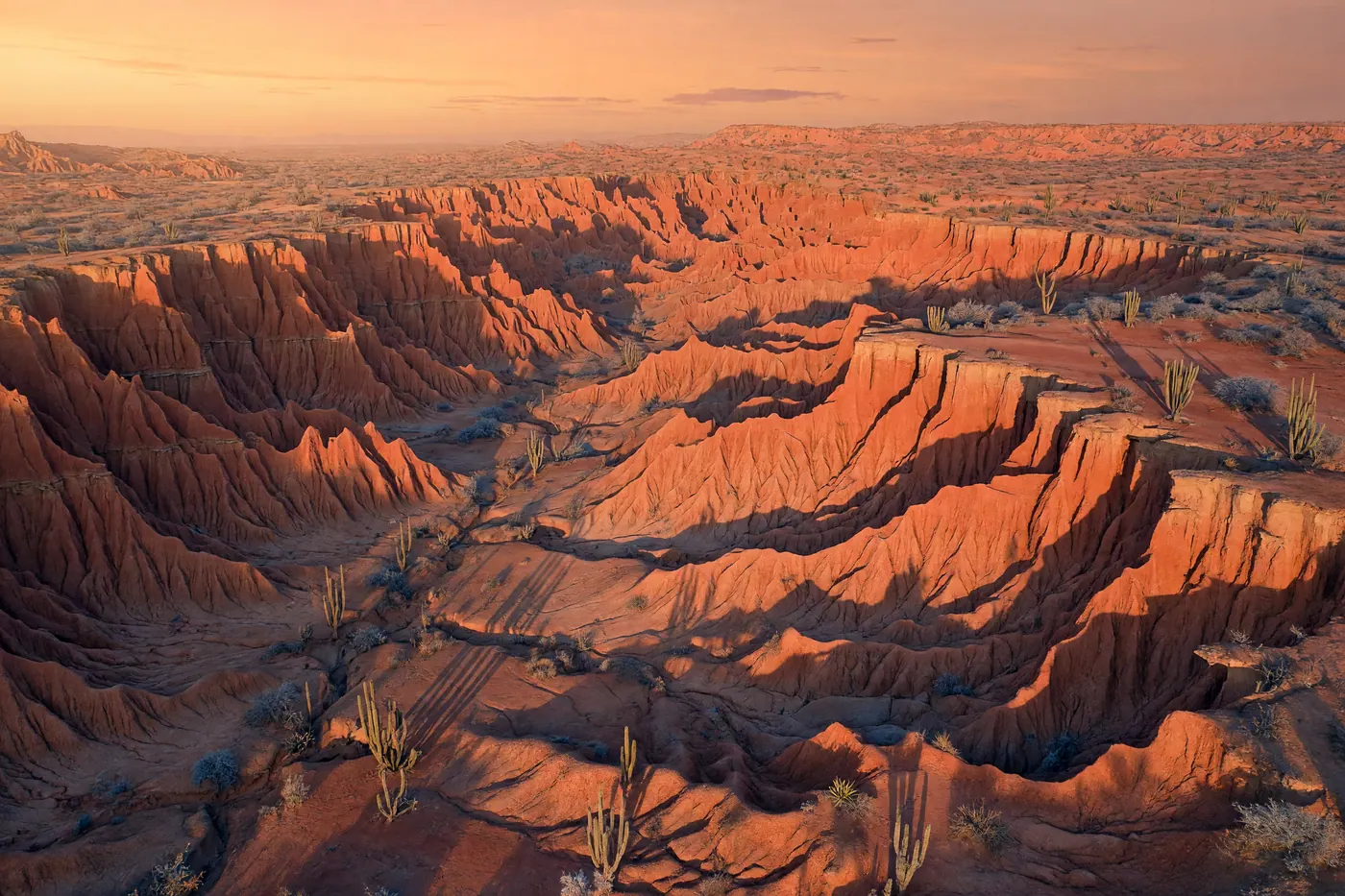
Ciudad Perdida: The One Everyone Should Do
Ciudad Perdida — "the Lost City" — is a pre-Columbian city built by the Tairona people around 800 CE, tucked into the Sierra Nevada de Santa Marta at around 1,300 meters. It predates Machu Picchu by roughly 650 years and sees a fraction of the visitors. The trek takes 4 to 6 days depending on operator.
You start near the village of Mamey, about 2.5 hours from Santa Marta by 4WD. The first day is the brutal opener — 7 to 8 hours through hot, humid forest with two river crossings. By day two, you're in cloud forest: cooler, misty, genuinely beautiful. On day three or four, you climb the famous 1,200 stone steps to the terraces of Teyuna, where Kogui and Wiwa indigenous communities maintain the site. Waking up there before the other groups arrive, with mist rolling over the terraces, is the moment that makes the first-day suffering worth it.
Operators and What It Costs
Only four authorized operators can legally run this trek: Expotur, Wiwa Tour, Magic Tour Colombia, and Turcol. Prices run $350–$420 USD per person, all-inclusive — mules for heavy bags, three meals a day, hammock accommodation, bilingual guides, permits, and round-trip transport from Santa Marta.
Wiwa Tour is community-run and a meaningful portion of revenue goes directly to indigenous communities. The guides are from those communities and the interpretive knowledge shows. If that matters to you, book Wiwa. Otherwise the experience is comparable across operators.
Don't try to negotiate significantly below list price. The permits and logistics actually cost what they cost.
Physical Requirements
This is not a casual day hike. Expect 6–8 hours of hiking per day on uneven terrain in heat and humidity, with river crossings that can reach waist depth in wet season. Healthy adults who train moderately can complete it — I've seen people in their late 60s do this without major issues. The ones who struggle are usually people who arrived underprepared, not people who are old or slow.
Train for 4–6 weeks beforehand with loaded walks on uneven ground. Trekking poles are optional but your knees will thank you on the descents. Bring more socks than you think you need.
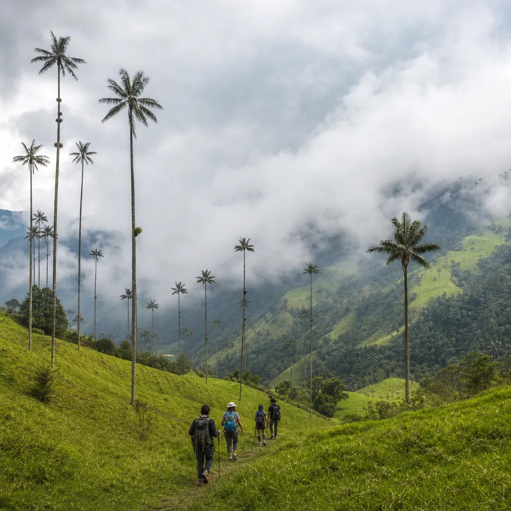
Cocora Valley: The Best Day Hike in Colombia
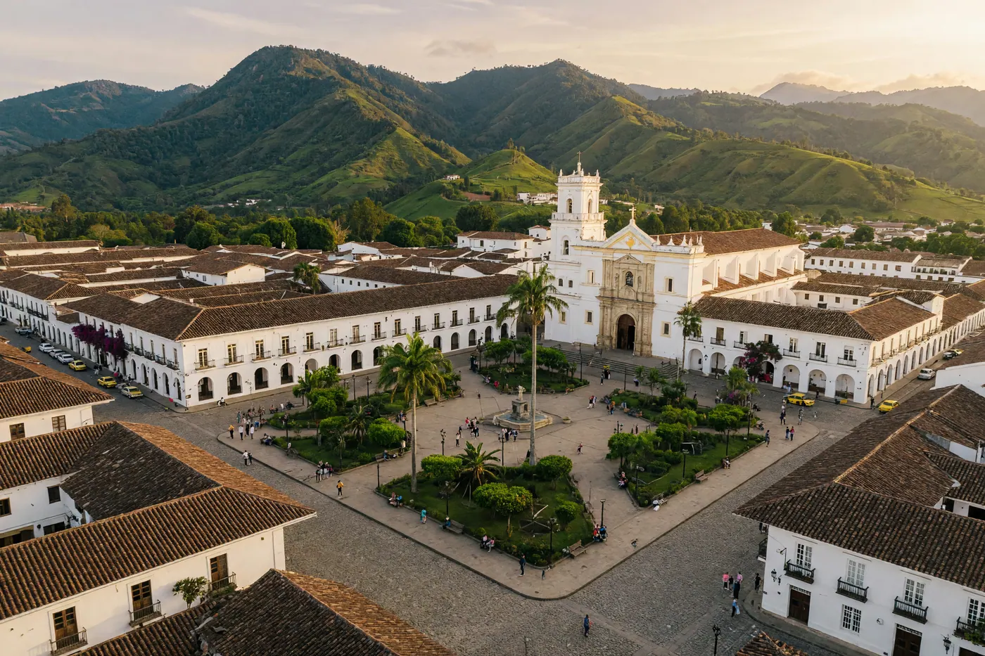
Cocora Valley near Salento is the most accessible hike on this list and probably the most photographed. Colombia's national tree — the wax palm, the tallest palm species in the world at up to 60 meters — grows in concentrations here that make the landscape look digitally altered. The classic loop from Salento takes 4–6 hours, climbs through humid cloud forest, and descends through the open valley with palms stretching into the cloud cover.
I'd call it moderate, not hard. The forest section has steep stretches and mud after rain. The valley floor is easy walking. Start before 7am to catch morning mist on the palms before the day-trip crowds from Medellín and Bogotá arrive.
No guide needed. Take a shared jeep from Salento's main square to the trailhead (they leave constantly, 3,500–4,500 COP each way), pay roughly 8,000–10,000 COP park entry, and follow the well-marked loop. One genuine warning: if it's rained recently, the forest section turns into a boot-filling mud situation. Pack gaiters or old shoes you don't mind destroying.
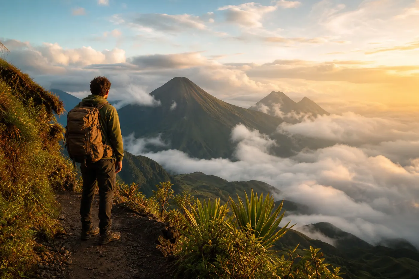
Los Nevados National Park: Trekking at 5,000 Meters
Los Nevados sits above Manizales and covers five volcanic peaks, including Nevado del Ruiz. Trekking here feels different from anything else in Colombia: above 4,000 meters, the cloud forest gives way to bleak páramo grassland, and the weather can shift from clear to whiteout in thirty minutes. It's genuinely dramatic terrain.
Day trips from Manizales take you to the visitors' center at 4,200m, with optional access to the glacier viewpoint above that. For multi-day routes through the park, you need a licensed guide — access is controlled to protect the páramo ecosystem. Recommended operators from Manizales: Ecosistemas and Ecoturismo Nevados.
Altitude Sickness Is Real
If you're arriving from Medellín (1,495m) or the coast, don't rush this. Spend at least two nights in Manizales before going up. Altitude sickness hits people unpredictably regardless of fitness level — I've seen marathon runners get flattened and sedentary travelers feel fine. There's no reliable way to predict who will struggle.
Acetazolamide (Diamox) is available without a prescription at pharmacies in Colombia for around 15,000–25,000 COP for a course. Start it 24 hours before ascending. If you feel bad — real symptoms, not just tired — descend immediately. That's the only treatment that actually works.
El Cocuy: For the Serious Hiker
El Cocuy National Park in Boyacá is where you go for glaciers and true high-altitude trekking. Twenty-two named peaks above 5,000 meters, páramo that looks like another planet, and almost nobody from the expat circuit. The classic circuit runs 3–5 days and sits between 4,000 and 5,000 meters throughout.
Gear requirements are real: sleeping bag rated to at least -5°C, full waterproofs, layered thermals, and proper boots. The town of El Cocuy (base camp, about 9 hours from Bogotá by bus) has gear rental shops that cover most gaps. Finca La Esperanza near the park entrance has been organizing community-based treks here for years and is the most reliable contact.
Note: glacier access has been restricted in recent years to protect the shrinking ice cap. Check current regulations before booking — they change and the park won't always proactively tell you. Going with a guide solves this because they navigate the access permits.
What You Need to Know Before Any Trek
A few things that come up on every hike and that most posts don't mention:
- Rain poncho, not an umbrella — you need two hands on technical terrain
- Trekking poles for multi-day routes — knees over descents, stability at river crossings
- Two pairs of socks per hiking day — not optional in wet conditions
- Quick-dry synthetic clothing — cotton is genuinely dangerous when wet at altitude
- Minimum 2L water capacity — on guided treks water is usually provided, but carry your own anyway
Best season across most routes: December–March and July–August are the driest windows. April–May and October–November are the rainiest. For El Cocuy specifically, wet season creates genuinely dangerous conditions on the glacial terrain — don't go then.
On insurance: most basic travel policies exclude adventure activities. World Nomads explicitly covers trekking including at high altitude, and you can buy it before or after arriving in Colombia (though before is cheaper and smarter). Sort this before you leave — not the night before the trek.
📚 Keep Reading
Tayrona National Park: The Honest Visitor's Guide — beaches, park closures, hammock accommodation, and logistics from Santa Marta.
Santander & Chicamocha Canyon: Colombia's Adventure Sports Capital — paragliding, rafting, and canyoning in San Gil without the multi-day commitment.
Frequently Asked Questions
❓ Is hiking in Colombia safe?
Yes, in the areas covered here. The main risks are altitude sickness above 3,500 meters and weather-related — not crime. Ciudad Perdida in particular is consistently safe; the indigenous communities that manage the site don't tolerate problems and the authorized operators have strong safety records. Stick to established trekking zones, use licensed operators for remote routes, and you'll be fine.
❓ Do I need a guide for hiking in Colombia?
Depends entirely on the route. Cocora Valley is easy to do solo — the trail is well-marked and busy enough that you're rarely alone. Ciudad Perdida, Los Nevados, and El Cocuy all require licensed guides for access, which is also a practical benefit because logistics, permits, and safety management are genuinely complex in those areas.
❓ How fit do I need to be for Ciudad Perdida?
Reasonably fit and willing to train. If you can hike 6–7 hours with a daypack without feeling destroyed, you can handle it. The heat and humidity on day one are the main challenge, not technical difficulty. Train with loaded walks on uneven ground for 4–6 weeks beforehand. The people who drop out are almost always the ones who didn't prepare, not the ones who are physically unimposing.
❓ What's the best hike for first-timers in Colombia?
Cocora Valley, without question. It's accessible from Salento — itself worth 2–3 days — takes one day, costs almost nothing, and the wax palm scenery is genuinely unlike anything else on the continent. Go early in the morning before the day-trip crowds arrive from the cities.
❓ When should I avoid hiking in Colombia?
April–May and October–November are the heaviest rainy months across most regions. Trails get dangerously muddy, river crossings become more serious, and mountain weather at Los Nevados and El Cocuy turns unpredictable. Ciudad Perdida can still be done in rainy season if you're prepared for the mud, but it's not the optimal experience. The dry windows in December–March and July–August are noticeably better.


Comments
Loading comments...
Checking sign-in status...